


4.5.3 ITS Role in Evacuation
Disasters may require evacuation of residents and visitors, sometimes from large areas and across multiple jurisdictions. From a traffic perspective, any evacuation is going to severely threaten the capacity of the transportation system to handle it. Most of the actions agencies can take to mitigate the negative impact of an evacuation and help keep traffic flowing require changes in the physical infrastructure or the use of mass-passenger modes. Here are some examples:
- In urban areas, entire city streets can be shifted to one-way operations to move larger numbers of vehicles away from harm. ITS plays a role here by minimizing the conflicting guidance that traffic signals might indicate (e.g., showing green displays in the wrong direction). These require large numbers of police or military officials to control traffic.
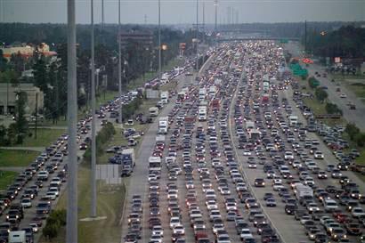
- Contraflow lanes can be used effectively to shift the inbound capacity for outbound evacuating traffic (Figure 4.5.3). Contraflow requires a great deal of planning, physical preparation (such as for the crossover lanes), large teams of officials to implement the plan, and time to deploy and later restore the area to normal. A number of states on the Gulf of Mexico and Southeast Atlantic Coast, even as far north as Baltimore, MD, have contraflow plans, but most would use these plans only as a last resort. ITS plays a role in using DMS to reinforce contraflow guidance, CCTV to monitor traffic, and ATIS to inform travelers, although most public information is generated by the incident command center. Most contraflow lanes are in rural areas without ITS; however, the increasing use of probe vehicles can give transportation and emergency managers data on travel times.
One challenge to emergency managers is unnecessary evacuations. Advanced Traveler Information System (ATIS) is another tool for discouraging people from unnecessarily evacuating. ATIS is a system that acquires, analyzes, and presents information to assist surface transportation travelers in moving from a starting location to their desired destination. An ATIS may operate through information supplied entirely within the vehicle (autonomous system) or it can use data supplied by the traffic management centers. Relevant information may include locations of incidents, weather and road conditions, optimal routes, recommended speeds, and lane restrictions, all part of the ITS. 1
The opposite of evacuations is the confinement of people within an area, for example to contain a potential pandemic. In this case, CCTV can show where vehicles are traveling when they should not be, and ATIS can augment public safety notices.
- 1'Advanced Traveller Information Systems(ATIS) | Intelligent Transportation System (ITS)'. Intranse.in. 2010-10-27.