Disaster Management Manual
A manual for practitioners and decision makers!

Disaster Management Manual
A manual for practitioners and decision makers!
Hurricane evacuation planning has become increasingly important as extreme weather events continue to increase in frequency and severity. Although hurricanes are among the most costly and dangerous types of natural disasters, they are also easily predicted and typically preceded by several days of advanced notice, allowing time to warn and evacuate large populations.
Hurricanes, known generically as tropical cyclones, are low-pressure systems with organized thunderstorm activity that form over tropical or subtropical waters (Figure 4.4.5.1). They gain their energy from warm ocean waters. Hurricanes, typhoons, and cyclones are actually all the same type of storm, but have different names based on where they form. In the North Atlantic and central and eastern North Pacific, these storms are called “hurricanes.” In the western North Pacific, they are called “typhoons” and in the South Pacific and Indian Ocean, they are called “cyclones.” (Tropical cyclones are rare in the South Atlantic.) 1
Tropical cyclones with maximum sustained surface winds of less than 39 miles per hour (mph) are called tropical depressions. Those with maximum sustained winds of 39 mph or higher are called tropical storms.
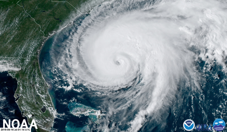
When a storm's maximum sustained winds reach 74 mph, it is called a hurricane. The Saffir-Simpson Hurricane Wind Scale is a 1 to 5 rating, or category, based on a hurricane's maximum sustained winds. The higher the category, the greater the hurricane's potential for property damage.
Hurricanes originate in the Atlantic basin, which includes the Atlantic Ocean, Caribbean Sea, and Gulf of Mexico, the eastern North Pacific Ocean, and less frequently, the central North Pacific Ocean. A six-year rotating list of names, updated and maintained by the World Meteorological Organization, is used to identify these storms.
Hurricane season begins on June 1 and ends on November 30, although hurricanes can, and have, occurred outside of this time frame. The United States National Oceanic and Atmospheric Administration (NOAA) National Hurricane Center predicts and tracks these massive storm systems, which occur, on average, 12 times a year in the Atlantic basin.
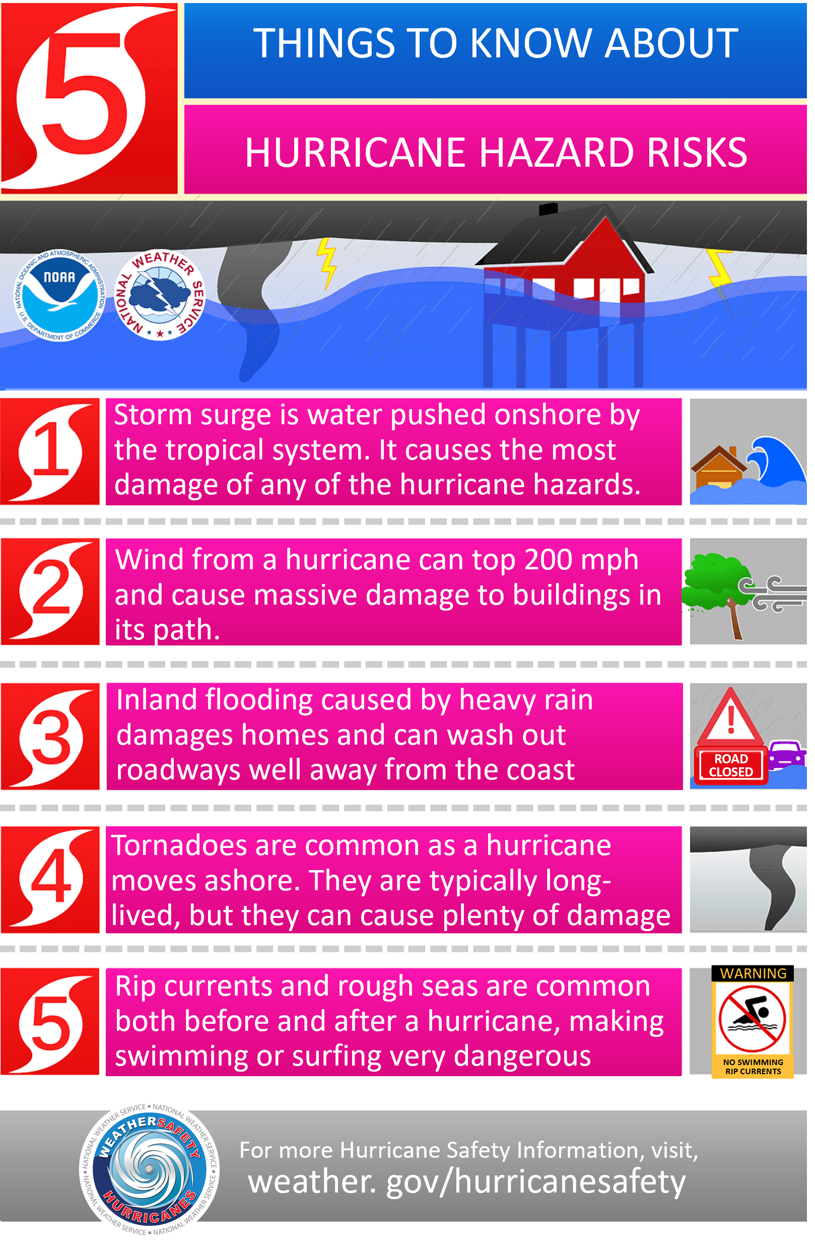
Hurricanes are dangerous and can cause major damage because of storm surge, wind damage, rip currents, and flooding (Figure 4.4.5.2). They can happen along any United States coast or in any territory in the Atlantic or Pacific oceans. Storm surge is historically the leading cause of hurricane-related deaths in the United States.
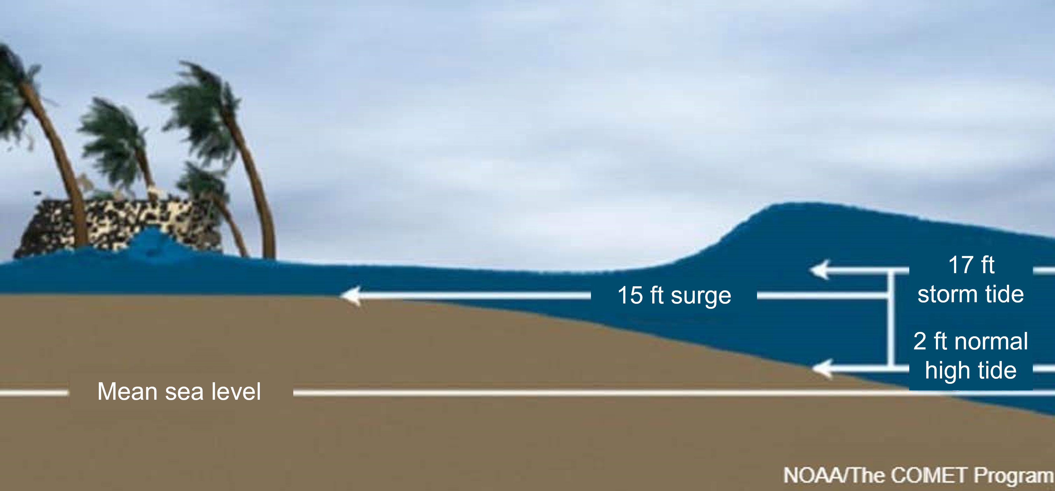
Storm surge is an abnormal rise of water generated by a storm, over and above the predicted astronomical tides. Storm surge should not be confused with storm tide, which is defined as the water level rise due to the combination of storm surge and the astronomical tide (Figure 4.4.5.3). This rise in water level can cause extreme flooding in coastal areas particularly when storm surge coincides with normal high tide, resulting in storm tides reaching up to 20 feet or more in some cases.
Storm surge is produced by water being pushed toward the shore by the force of the winds moving cyclonically around the storm (Figure 4.4.5.4). The impact on surge of the low pressure associated with intense storms is minimal in comparison to the water being forced toward the shore by the wind.
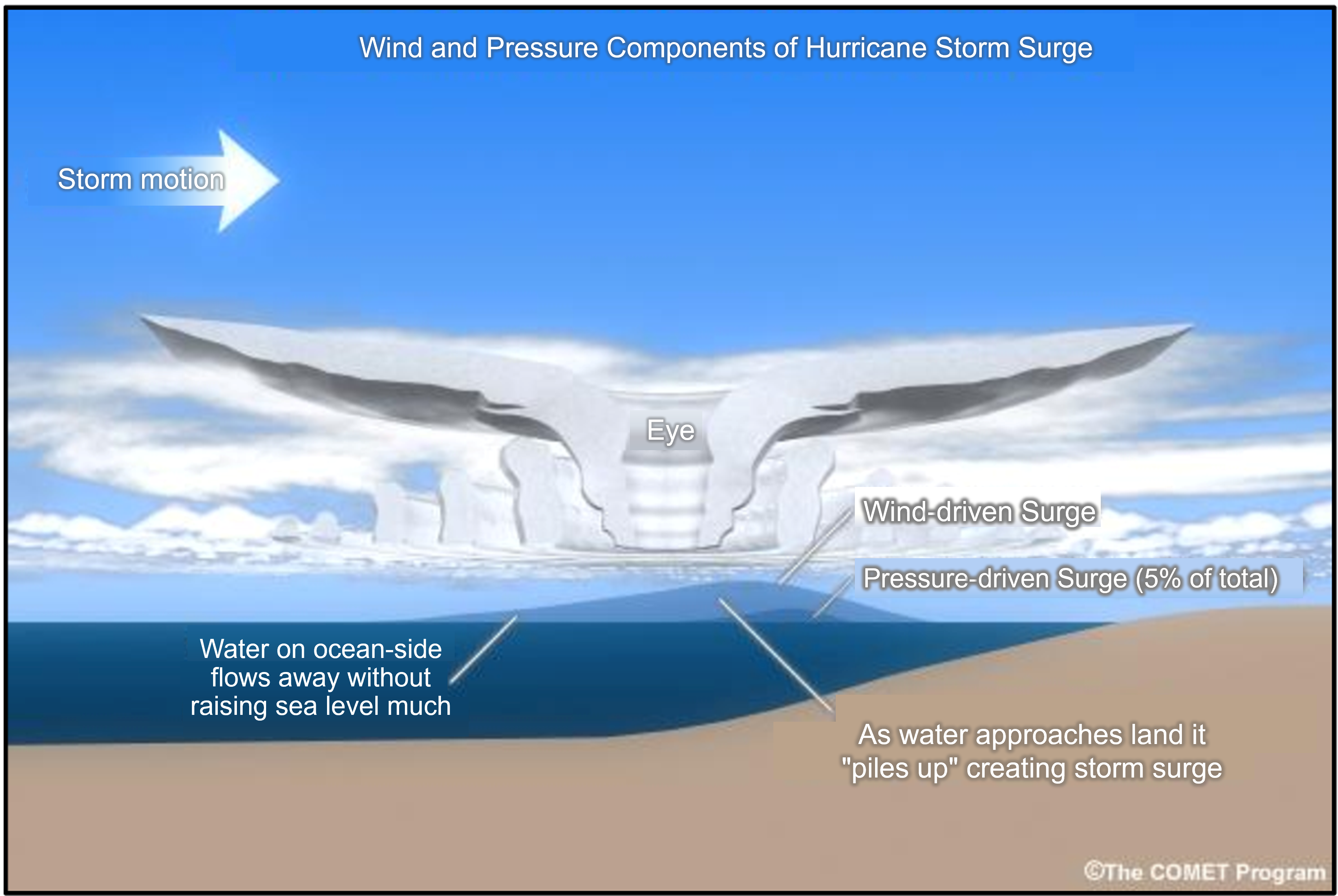
The maximum potential storm surge for a particular location depends on a number of different factors. Storm surge is a very complex phenomenon because it is sensitive to the slightest changes in storm intensity, forward speed, size (radius of maximum winds-RMW), angle of approach to the coast, central pressure (minimal contribution in comparison to the wind), and the shape and characteristics of coastal features such as bays and estuaries.
Other factors which can impact storm surge are the width and slope of the continental shelf. A shallow slope will potentially produce a greater storm surge than a steep shelf. For example, a Category 4 storm hitting the Louisiana coastline, which has a very wide and shallow continental shelf, may produce a 20-foot storm surge, while the same hurricane in a place like Miami Beach, Florida, where the continental shelf drops off very quickly, might see an 8 or 9-foot surge.
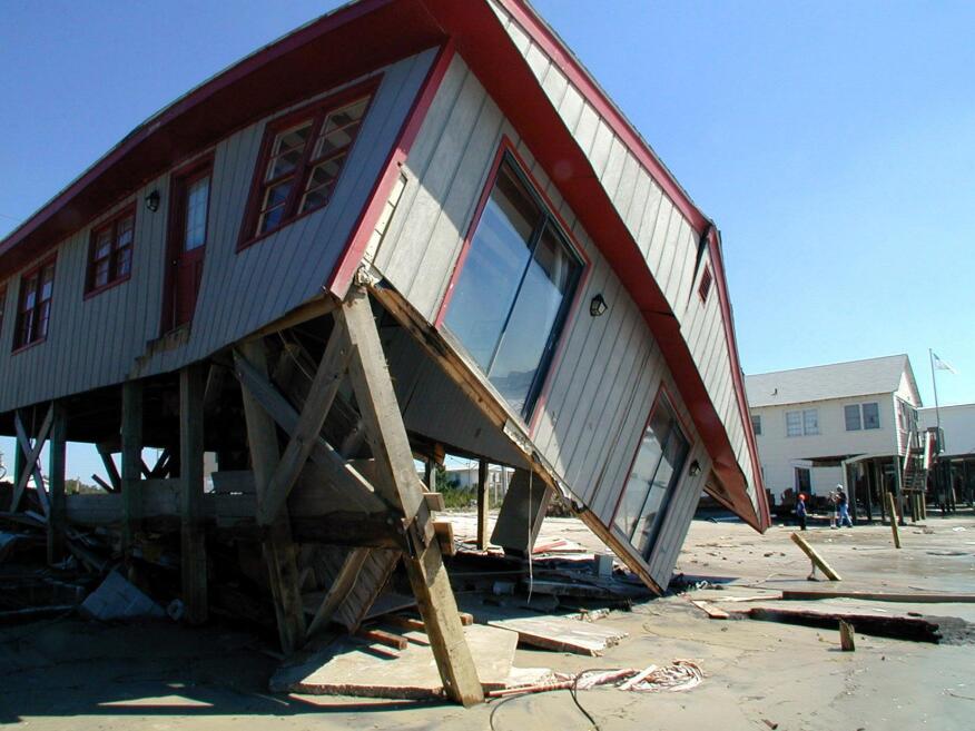
Adding to the destructive power of surge, battering waves may increase damage to buildings directly along the coast (Figure 4.4.5.5). Water weighs approximately 1,700 pounds per cubic yard; extended pounding by frequent waves can demolish any structure not specifically designed to withstand such forces. The two elements work together to increase the impact on land because the surge makes it possible for waves to extend inland.
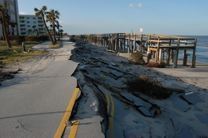
Additionally, currents created by tides combine with the waves to severely erode beaches and coastal highways (Figure 4.4.5.6). Buildings that survive hurricane winds can be damaged if their foundations are undermined and weakened by erosion. 2
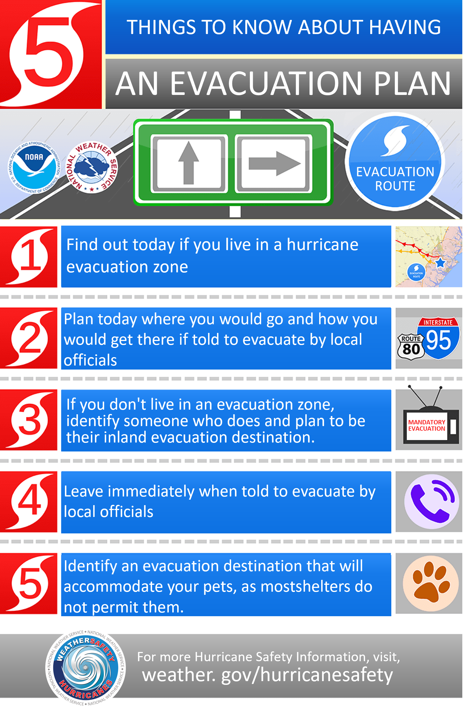
Hurricane evacuation is the immediate and rapid movement of people away from the threat or actual occurrence of a hurricane. Emergency managers and other officials may recommend a voluntary evacuation or order a mandatory evacuation. Understanding the risks and having an evacuation plan prior to a disaster event is critical, Figure 4.4.5.7 provides information related to evacuation planning considerations. Due to the numerous hazards related to hurricanes, evacuating should always be an option during strong hurricanes.
Despite mandatory evacuation orders many individuals still refuse to leave their homes. Some residents may believe that due to the monetary cost of evacuation and not being present to care for their home, evacuation is not a good choice. Officials advise that people who are not evacuating to carefully monitor severe weather updates provided by emergency broadcasting services, since the direction and potential danger of a hurricane may change suddenly.
A hurricane evacuation route (also called coastal evacuation route or evacuation route) is a highway that is a specified route for hurricane evacuation. Along the Gulf Coast, hurricane evacuation routes lead north and west for up to hundreds of miles to the safest major city. Along the Atlantic Coast, routes lead west. They are marked with blue signs that point in the correct direction (Figure 4.4.5.8).
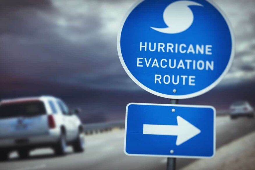
During mass evacuations, these roads (and especially interstate highways) have been set up with paved crossover lanes so that both north and southbound lanes flow north and west and eastbound lanes flow west, a procedure known as contraflow. Utilizing shoulders of evacuation routes during a disaster can also increase traffic flow out of an evacuation area.
Several US coastal states have implemented a “Know Your Zone” public education campaign to inform residents (Figure 4.4.5.9), businesses and visitors of the hurricane evacuation zones and their vulnerability to storm surge.
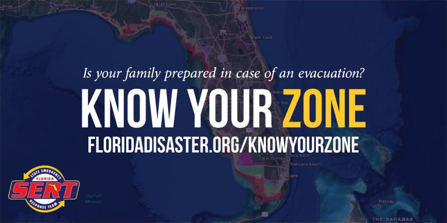
When a storm is approaching, emergency managers will determine which zones are most at risk considering the intensity, path, speed, tides, and other meteorological factors. Emergency managers at the state and local level will work with local media and use social media and other tools to notify residents of impacted zones what they should do to stay safe.
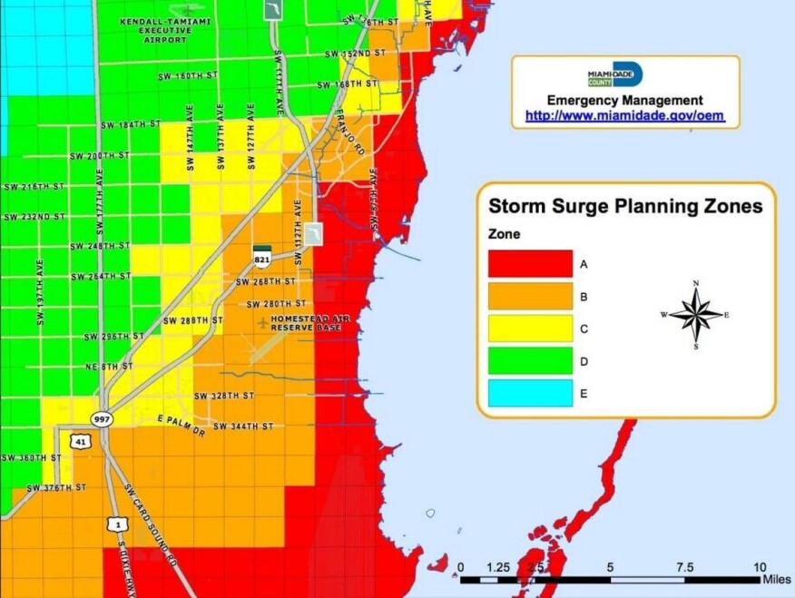
In Florida, evacuation zones are designated by letters (Figure 4.4.5.10). Vulnerability may be assumed to increase as the designations go from Zone A to Zone E, with Zone A as the most vulnerable. Locations utilizing designated evacuation zones will use the letters when they order evacuations.
