Disaster Management Manual
A manual for practitioners and decision makers!

Disaster Management Manual
A manual for practitioners and decision makers!
Exposure defines the elements and locations of the highway system (roads, bridges, culverts, etc.) that may be exposed to changing conditions caused by climate change, including sea level rise, storm surge, wildfire, landslides, etc. Key indicators for this measure include the value and timing of expected changes (at what year could you expect these conditions to occur). 1
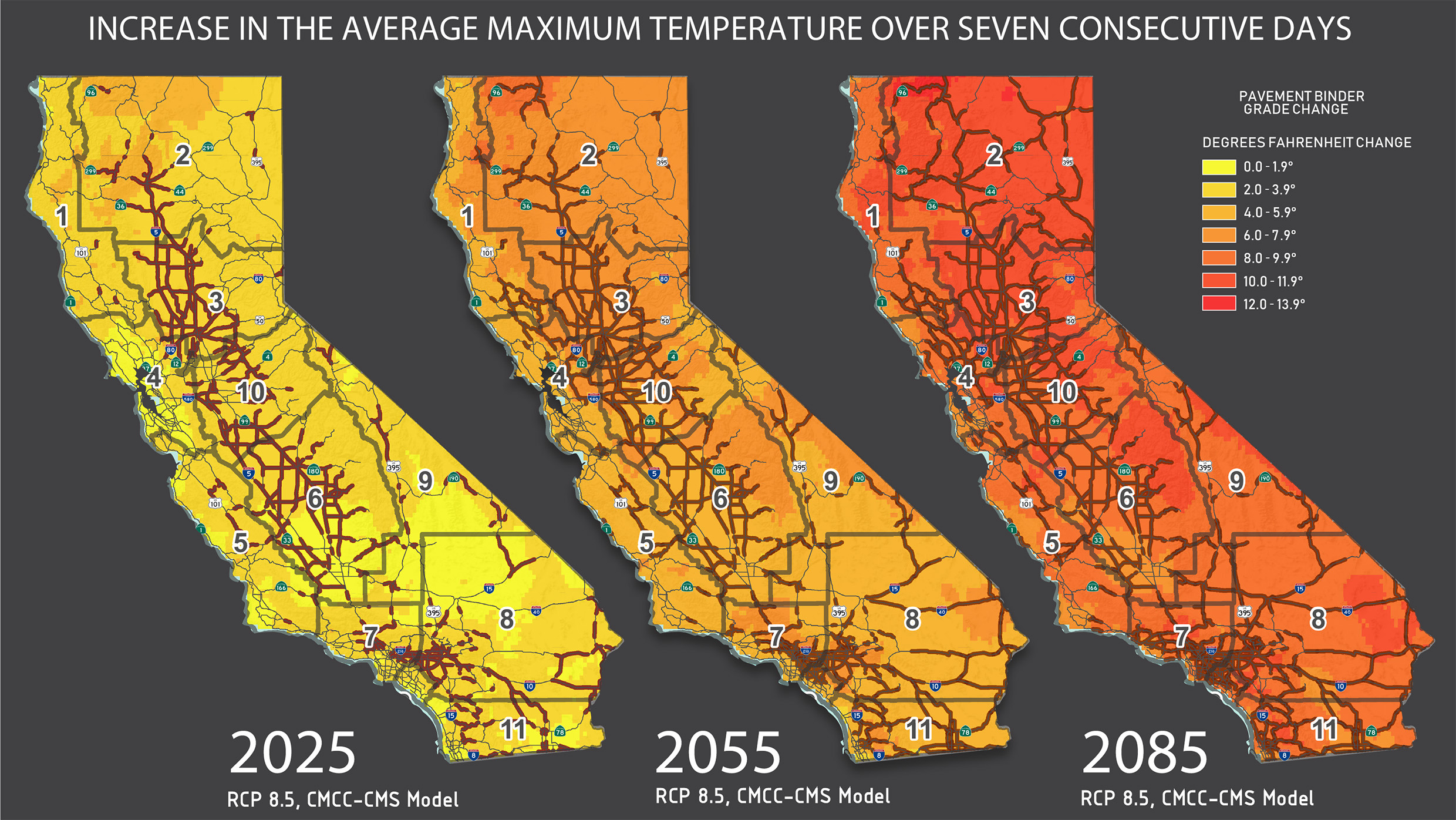
‘According to the United States National Climate Assessment, the number of extremely hot days is projected to continue to increase over much of the United States, especially by late in the century. Summer temperatures are projected to continue rising, and a reduction of soil moisture, which exacerbates heat waves, is projected for much of the western and central US in summer. California’s size and its many highly varied climate zones cause inconsistent temperature rise across the state. The following Figure shows the average maximum temperature change over seven consecutive days within three different time periods compared to data from 1975 to 2004. Caltrans evaluated the minimum and maximum temperature changes because they are important considerations for selecting pavement binder–the “glue” that binds asphalt aggregates. The Figure highlights portions of the State Highway System where the historical pavement binder temperature range is exceeded. Notice that as time goes on, more of the network becomes exposed to high temperatures that could affect pavement conditions.’ 2

Caltrans vulnerability studies contain similar mapping for statewide precipitation, wildfire, sea level rise, storm surge and cliff retreat.